Restoration opportunities in the heart of DRC
IUCN, the government, partners, and a key local governance working group collaborate to ensure sustainable land management in the Democratic Republic of Congo’s Mangai landscape – through the application of the restoration opportunities assessment methodology.
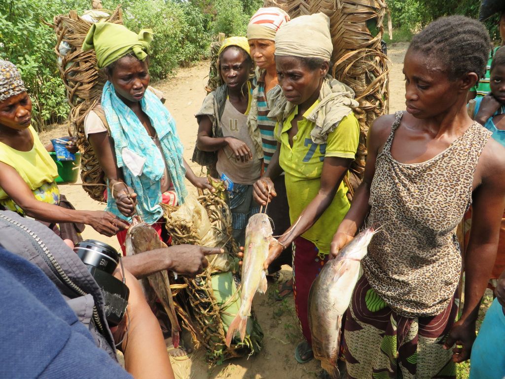
In the Democratic Republic of Congo (DRC), poverty remains a major challenge. Many of the people affected by poverty live in rural areas and are small farmers. These populations depend heavily on natural resources for survival. However, in some landscapes, these resources are severely degraded, and forest cover continues to decline. Agricultural productivity is hampered by soil erosion as a result of deforestation and overexploitation of agricultural land. The forest landscape restoration (FLR) approach helps to address these challenges.
This is a major reason why the DRC pledged to restore 8 million hectares of degraded and deforested land as part of its commitment to the Bonn Challenge. FLR is also a key approach for achieving goals set in the frameworks of the UNFCCC Nationally Determined Contributions (NDCs), the Sustainable Development Goals (SDGs), and other global aspirations for which the DRC is committed.
It is in this context that IUCN collaborates with the government of the DRC through the Congolese Institute for the Conservation of Nature (ICCN) for the implementation of the land-use stabilization (PLUS) project in the Mangai landscape. An important component of this collaboration is to conduct an assessment of restoration opportunities available in this area. The restoration of ecosystems in Mangai aims, among other things, to meet current and future biodiversity conservation needs, to increase carbon sequestration capacity, to improve soil productivity, and to improve the local economy.
The Mangai Hunting Area and Hippopotamus Reserve, within the Mangai landscape, is a protected area located in the south-west of DRC – in the Idiofa territory of Kwilu Province and the Oshwe territory in Mai Ndombe Province. The landscape retains significant biological value, although the ecosystems are under intense human pressure, and are severely degraded.
To help identify landscape restoration options, IUCN and ICCN turned to a proven assessment tool called the Restoration Opportunities Assessment Methodology (ROAM).
A ROAM process in the Mangai landscape was launched in April 2018, and completed in March 2019. It was carried out through four main stages and faced various challenges.
Stage 1 : Data collection and stakeholder consultations
Data collection and assembly was done in two stages: (1) collection of secondary data or existing information, and (2) collection of primary data or information from stakeholder consultations. Consultations were organised at the national level in Kinshasa and at the local level in Idiofa and Mangai, and made it possible to supplement secondary data.
The collection of primary data mainly consisted of exchanges and discussions with resource persons in Idiofa and Mangai, stakeholder consultations in Kinshasa and with local communities in the Mangai landscape, and through direct observations. Field visits provided verification of secondary socio-economic information of the sites, including local stakeholder initiatives and land use practices in the Mangai landscape.
Stage 2: Production of thematic maps
The production of different types of landscape maps was a milestone in this process. The methodology consisted of identifying and classifying land degradation criteria or proxies through spatial analysis, field observations and community consultations. It was based on the location of these degraded areas, coupled with the potential of each zone, that the local communities, with the support of the technical team, were able to identify the best restoration options.
The team found that in a landscape where data is not available, and areas are inaccessible, it is sometimes difficult to verify the information. This was noted for the case of Mangai – the fieldwork made it possible to identify some areas that had not been taken into account in the production of the base map and to identify possible errors that will be corrected during the production of future landscape maps. It should also be noted that opportunities were only assessed in the southern part of the landscape – forest cover the northern section remains nearly intact.
Stage 3: Identification of the most degraded areas, and options for restoration
Around 50 participants took part in each of the workshops held in Mangai and Idiofa. In addition to experts from ICCN and IUCN, representatives of the public sector and civil society, community thematic associations, land chiefs, a religious representative, private sector and training institutions – including women and young people – took part in these workshops. Reflections focused on the types of degradation as well as the most affected areas, causes, impacts and restoration options.
In addition to these workshops, bilateral meetings provided specific information on the history of conservation and development in the Mangai landscape, as well as socio-economic and environmental statistics.
These consultations and field visits led to the validation of the priority intervention areas for restoration aimed at the creation of conservation areas without compromising the agricultural and forestry activities of local populations, and while reducing the impacts of agriculture on forests and savannas. Other priorities included: reforestation and agroforestry, the restoration of road infrastructure, natural regeneration of ecosystems, and the stabilisation of banks and ravine beds.
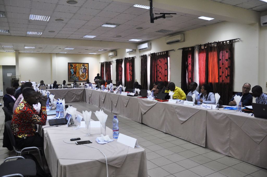
Stage 4: Presentation and validation of national level results
To communicate and validate the results of the restoration opportunities evaluation at the national level, a two-day workshop was organised in Kinshasa by IUCN and PLUS partners, namely ICCN, OCEAN and TFD. This workshop was attended by the private sector, donors, technical and financial partners, government technical institutions, sectoral ministries (Ministries of the Environment and Sustainable Development, Agriculture and Territorial Development ), national NGOs, the Kwilu Provincial Environmental Coordination organisation and the Idiofa Territory Administration, representatives of the Mangai landscape governance working group, and the Curator of the Mangai Hunting Area and Hippopotamus Reserve.
At the end of this workshop, the results of the ROAM were validated and relevant recommendations were formulated in relation to the challenges, strategies and synergies identified to ensure the implementation of the restoration options in terms of mobilising both financial and human resources.
Conclusions and lessons learned
A list of priority intervention types to restore the Mangai landscape has now been established, and the challenges related to implementation are identified. The cost of implementation has also been analysed, and certain financing and investment options brought to light. Results of this work will be useful for the development of the Mangai management plan as well as for the functioning of the Mangai governance working group, and for local projects that have a significant impact on biodiversity conservation and local development.
It is also important to mention that the Ministry of Environment and Sustainable Development, responsible for the implementation of DRC's commitments to the Bonn Challenge and to land degradation neutrality efforts, plans to incorporate information from the Mangai landscape assessment into national processes related to international commitments. IUCN will support this process through PLUS in a technical capacity.
Among the lessons learnt, the implementation of the ROAM in the Mangai landscape highlighted the importance of working through a previously established local structure capable of grouping the different stakeholders and resource users. This local structure facilitates the identification of communities to consult at the landscape level to discuss ownership and restoration options. In this case, the ROAM process in the Mangai landscape drew from the experience of the governance working group recently put in place by the PLUS project.
—Story by Grace Baruka, IUCN Country Coordinator, Stabilizing Land Use Project, Democratic Republic of Congo