Viet Nam: Participatory 3D Mapping exercise held with 21 local villages in and around Cuc Phuong National Park (CPNP)
Participatory 3D Mapping (P3DM) is an exciting method that has been implemented to support the process of knowledge sharing and collaboration with local and indigenous peoples for the success of effective management of protected and conserved areas. P3DM integrate local and indigenous spatial knowledge with technology to produce both physical and geo-referenced 3D models. The physical nature of the method enhances discovery learning through verbal, visual and tactile experiences, stimulates feedback, promotes debate and negotiation and generates shared information in visible and tangible formats. It increases the participant’s awareness about their spatial knowledge and enhances capacities to analyse, communicate and interact on specific issues, including tourism, conservation and resource management.
Photo: IUCN
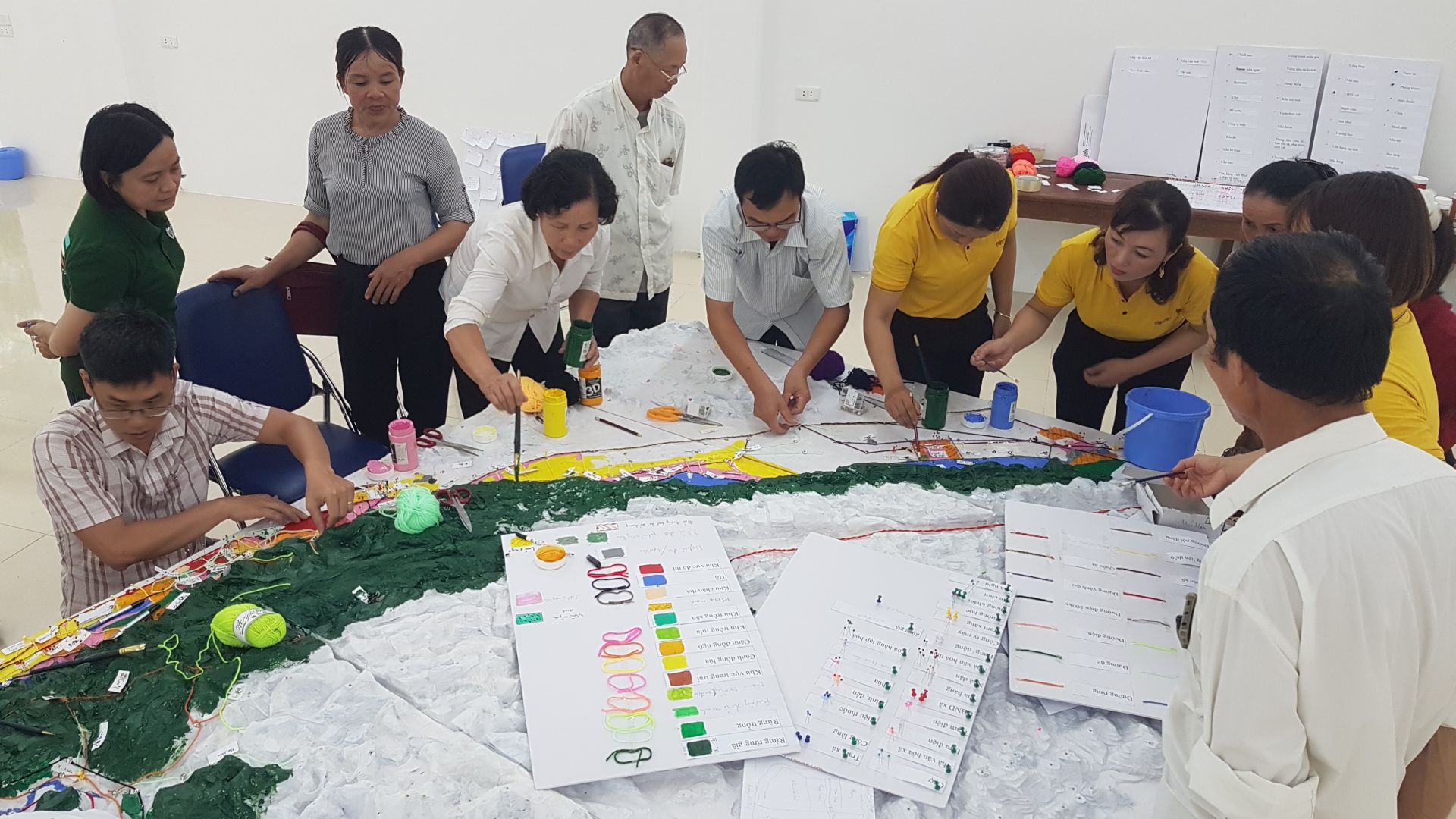
Photo: IUCN
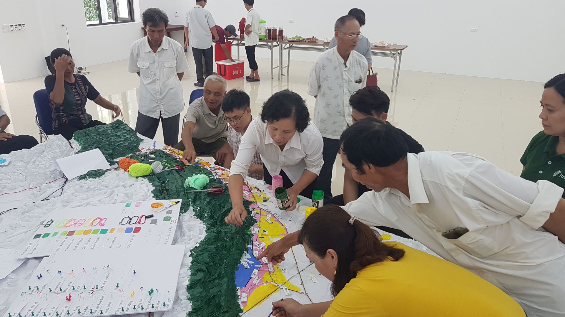
Photo: IUCN
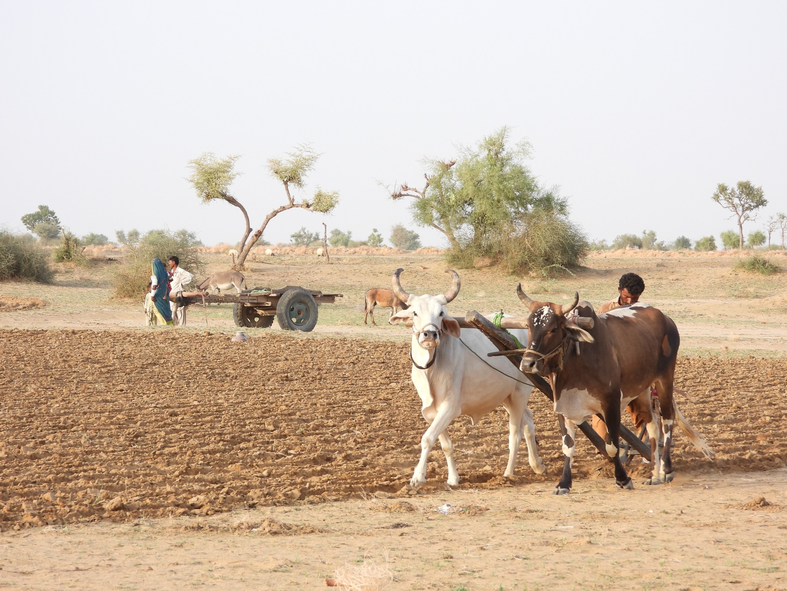
Within the projects ‘Sustainable Tourism and Protected Areas in a Post-COVID World’ and ‘Protected Areas Solutions’, a P3DM exercise was undertaken with 21 local villages in and around Cuc Phuong National Park (CPNP) in Northern Viet Nam. The aim was to address challenges in sustaining viable ecotourism products in and around the National Park and engage the local ethnic Muong communities in developing new sustainable and resilient community-based ecotourism itineraries that also support post-COVID-19 recovery. In addition, the P3DM also aimed to engage the communities in assessing and discussing impacts of COVID-19 on local resource use.
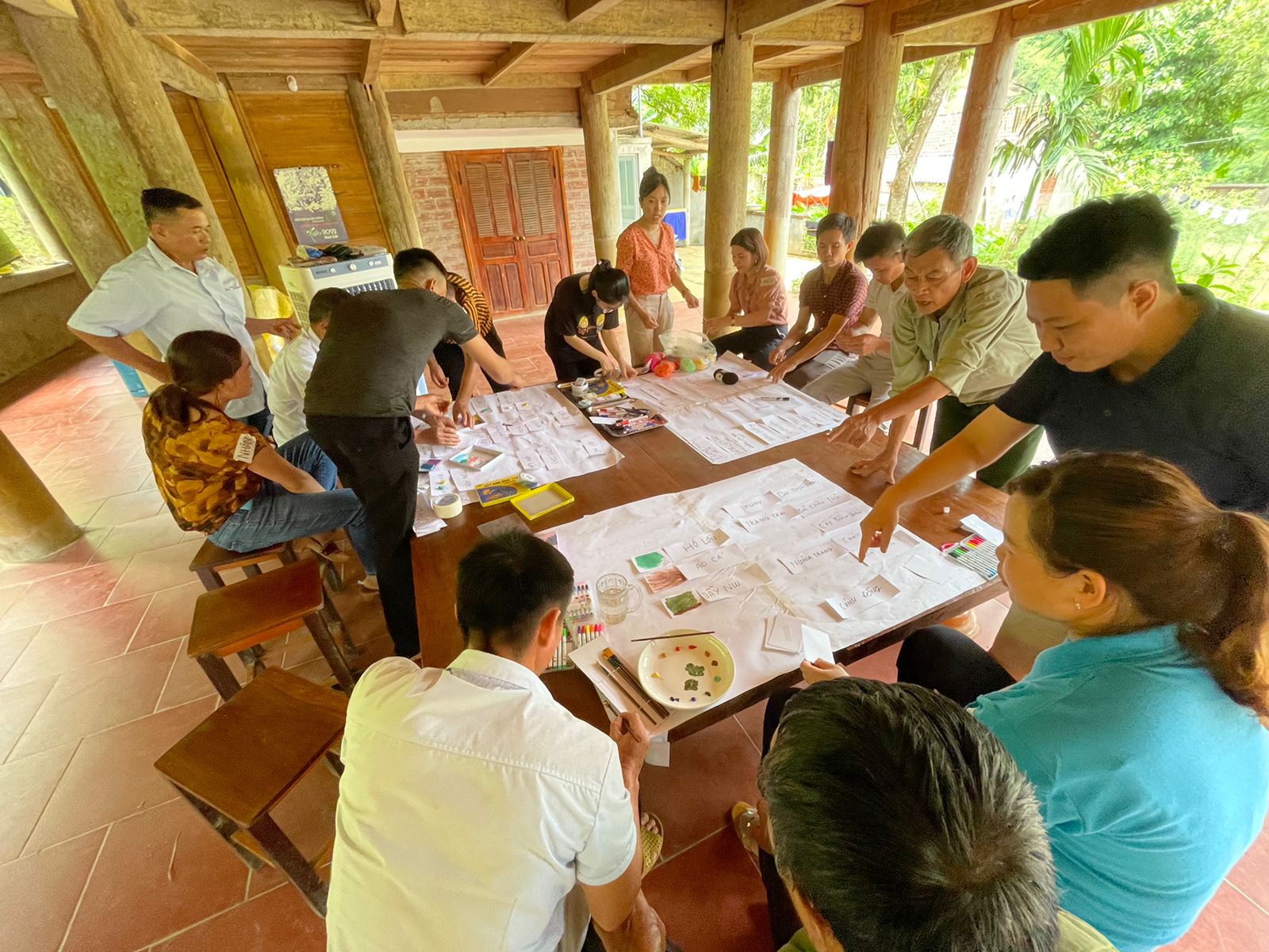
The exercise was undertaken in five main steps, starting with a participatory legend making workshop, allowing participants to express concepts and features to be visualised and coded on the 3D model. The process can help reclaim lost memories about the traditional ways of living. In the presence of elders and youth, it facilitates intergenerational knowledge exchange and raises awareness across generations about the status of the environment. One senior village member expressed a feeling of “getting a ticket to come back to my childhood” when mapping his local community and surroundings.
The second step was the blank model making, where high school students of the Nho Quan B School in Nho Quan district, Ninh Binh province, were engaged in building the physical model out of foam boards. The students were very excited to build this model and stayed on late in the evening to complete it. CPNP is located in a mountainous karst landscape with many peaks and valleys, making it a very challenging model to build. The students produced a video to showcase their achievement.
Once the blank model was completed, members from the 21 local Muong villages were invited back to populate it based on recollections from their memories. Land use, vegetation cover, species information, sacred places and other natural, cultural and social features were depicted by the knowledge holders on the 3D model using paint, yarn, pins and labels. The model maps out the relationships between natural and cultural features and allows participants to document and locate their tangible and intangible heritage and show cultural sites, knowledge systems and important physical sites, as well as the potential for community-based ecotourism activities. Populating the blank model supports community cohesion and self-determination by gathering people to share information and concerns that reinforces actualisation through the revival of local knowledge. In providing open access to information, the 3D model add transparency and create a common ground for discussion. It also bridges barriers and ease communication with protected area management authorities on issues linked to the protected area and its resources.
The fourth step comprised the presentation of the 3D model and handover ceremony from the local communities to the CPNP Management Board. The event was held on 5 July with the attendance of representatives from the local communities and high school students that contributed to the exercise, the CPNP Management Board, IUCN, local authorities and local NGOs, as well as directors from other Protected Areas in Viet Nam, which could be potential partners in replicating the exercise. The event was also covered in local and national media as well as TV.
The last step in the process is the digitising of the physical 3D model and entering the information (i.e. features) as layers into Geographical Information Systems (GIS). Once the information on the model has been digitised, other spatial data such as administrative and political boundaries, can be integrated. The physical and digital models are living versions of the area that can be added to as more information becomes available. P3DM is a method that brings the potential of GIS closer to rural communities and bridges the gap that exists between geographic information technologies and capacities found among communities dependent on natural resources.
We would like to express a special thanks to Giacomo Rambaldi (Senior Advisor and International Consultant for Participatory 3D Mapping), Dr. Vu Kim Chi (Vice director, Institute of Vietnamese Studies and Development Science, Vietnam National University), Dr. Nguyen Vu Giang (Head of Department of Remote sensing Technology, GIS & GPS Space Technology Institute) and Planeterra Foundation for their support in implementing this exercise, as well as the high school students from Nho Quan B School in Nho Quan district who built the 3D model and members of the 21 villages who participated in the exercise, shared their knowledge and inputted into the model.
These villages were:
Bản Khanh and Xóm Hổ from Lạc Sơn district, Hoà Bình province;
Xóm Sấu, Khu phố Khang Chóng, Xóm Cả, Trung Hoa 1, Minh Thành and Xóm Liêu from Yên Thủy district, Hoà Bình province;
Yên Mỹ, Xuân Viên, Bản Nga 1, Bản Nga 2 (xã Cúc Phương) and Sấm 3 (xã Cúc Phương) from Nho Quan district, Ninh Bình province;
Thành Tân, Yên Sơn 2 (Thành Yên), Đồng Luật, Bản Thống Nhất, Biện (xã Thạch Lâm), Nội Thành (xã Thạch Lâm), Bản Đồi (xã Thạch Lâm) and Bản Nghéo (xã Thạch Lâm) from Thạch Thành district, Thanh Hoá province.
In Kashkadarya, Khorezm and the Republic of Karakalpakstan, local communities are helping turn…
The third in a five-part series, this webinar brought together speakers from across West and…

This week, the Yerevan Municipality hosted the inaugural ceremony marking the establishment of the…