Smallholder farmers, local ecological knowledge and climate change
In the rural village of Amphoe Khlong Khuean in Chachoengsao Province, central Thailand, small-scale farmers living in wetland areas along Bang Pakong River met with IUCN staff and partners to discuss the impacts of climate change and development on local livelihoods. Using a series of participatory rural appraisal (PRA) approaches, IUCN staff and representatives from the local non-profit Pakee Bangpakong assisted villagers in mapping out historical timelines of extreme weather events as well as the geographic distribution of wetland resources within the village.
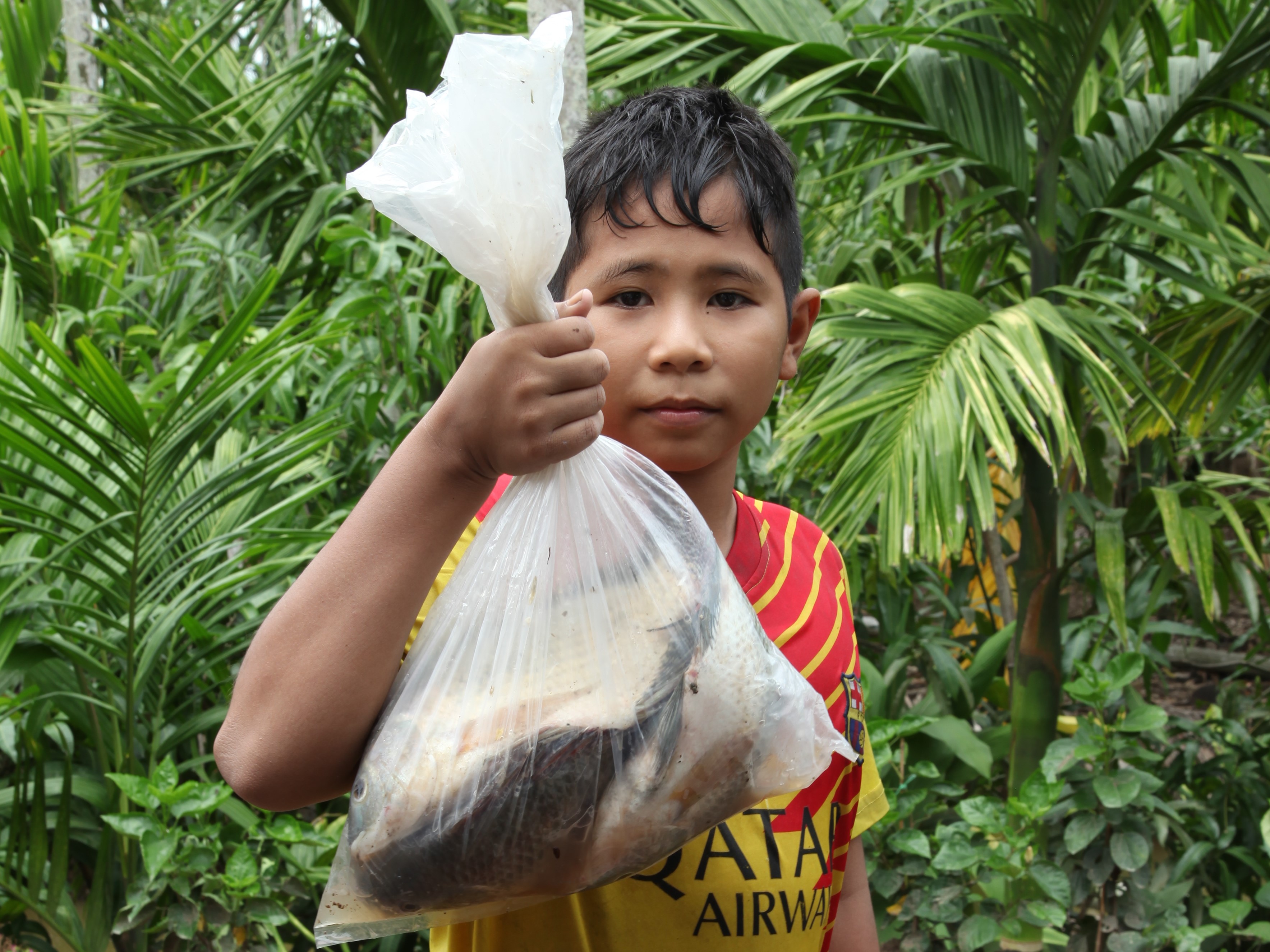
A boy holds up the fish he caught with his bare hands on the family property. While families in the village rely on fruit sales for income, they catch fish like these to eat.
Photo: © Annie Arbuthnot / IUCN
Image caption: A boy holds up the fish he caught with his bare hands on the family property. While families rely on fruit sales for income, they catch fish like these to eat.
Participants discussed the importance of edible wetland resources such as wild bitter cucumber, morning glory, various species of fish, and nipa palm, to name a few. Nevertheless, for community members like Sirin Montkutong who have lived along the river their entire lives, wetland resources provide more than just products to eat or sell — they offer a sense of local culture and place. “I wake up to the sight of nipa palm every day,” said Sirin fondly, before rattling off a list of the plant’s unique uses, including construction of roofs and walls. “In many areas, people steam and wrap food with banana leaves,” she stated, then added proudly, “but here, we use nipa palm.”
Like many individuals from the community, Sirin is a small-scale farmer who relies on the river for her livelihood. The gardens in this particular area of Khlong Khuean District are impossible to separate from the wetland. Fed by hundred-year-old canals connecting them to Bang Pakong River, the gardens are comprised of dirt walls or mounds separated by wide irrigation ditches. Cultivated on the dirt walls are income-producing fruit trees, most notably coconut, betel nut, and mango. Participants agreed that 100% of the community relies on agriculture or aquaculture for their livelihoods.
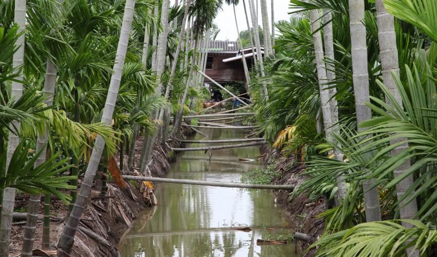 Photo: © Annie Arbuthnot / IUCN
The techniques used by farmers in this area are just as unique as the gardens themselves. The ditches serve several purposes—they not only ensure that freshwater will remain available for fruit trees during the dry season, but they also act as spawning grounds for fish from the river. The raised walls, on the other hand, keep trees from being inundated with water and prevent tree roots from reaching the salinity found in deeper soils. This means that great care must be taken each year when the ditches are dug by hand. Too shallow, and the ditches will run out of water during the dry season; too deep, and they may become contaminated with salt water from below.
The gardens are an excellent example of how communities use local ecological knowledge to adapt to seasonal rainfall patterns and climatic conditions. However, as temperatures increase and rainfall patterns become less predictable, small-scale farmers are dealing with both more intense periods of drought and more intense rainfall. During the visit, farmers told the IUCN team that fruit trees fail to produce adequate fruit in very hot years — coconuts are tiny and lack water on the inside, whereas mango trees only produce half their typical amount of fruit. Higher temperatures have also led to an increase in insect pests which damage the trees.
Flooding poses other issues — when water levels are too high, trees suffer and fish living in the irrigation canals swim away. Communities are therefore stuck in a difficult situation. In times of severe drought, the irrigation channels may dry up completely, transforming what was once a prolific fish spawning ground into dry earth. When there is a flood, fish swim back into the river, leaving the farmers without a reliable protein supply nearby.
“Flooding is the greatest climate threat in this area because it damages everything,” said Pramote Worachattakul, the owner of the farm where the meeting took place. “It is very difficult to prevent damage from a large flood.”
During the last major flood in 2012, gardens in the area were inundated for a month, resulting in the loss of most fruit crops. Some farmers have expressed fears that local varieties may even begin to go extinct. For example, although the area still boasts over 50 varieties of mangoes, one farmer told the group he has not been able to find a replacement for one of his trees that died after the flood. He thinks the variety may no longer be available anywhere.
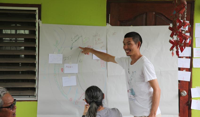 Photo: © Annie Arbuthnot / IUCN
After listening to the community’s concerns, the IUCN and Pakee Bangpakong facilitators directed the conversation to local climate projections and asked community members how they might cope with future impacts. This allowed villagers to share amongst themselves the techniques they were already using to cope with the changing climate, and evaluate whether these approaches would be successful in the long term. Some farmers have adapted to droughts by digging extra pools on their land to hold water in the dry season. Others are coping with pest outbreaks by encouraging the growth of plants that repel harmful insects. Although farmers have attempted to hold back flood waters with irrigation gates and sand bags, participants agreed that they needed better long-term solutions for severe floods.
In the coming weeks, IUCN and Pakee Bangpakong will work in concert with the Amphoe Khlong Khuean community to address these issues by conducting a climate change vulnerability assessment (VA) of the area’s habitats, wetland livelihoods, and species. The VA is the first step to addressing climate change vulnerabilities for wetland ecosystems and livelihoods under the German government-sponsored project Mekong WET: Building Resilience of Wetlands in the Lower Mekong Region through a Ramsar Regional Initiative. The assessment will also help the groups work towards another common goal: to have Bang Pakong River named a Ramsar site, or wetland of international importance. Much of the same ecological data needed to complete the full vulnerability assessment will also be used to complete the site’s Ramsar Information Sheet (RIS), a prerequisite for achieving the Ramsar designation.
Despite the challenges of climate change, the community remains optimistic, eager to work with IUCN and partners to pinpoint additional areas for adaptation while protecting the river they love.
The visit to Khlong Khuean District was part of a larger training on the use of a set of tools to conduct vulnerability assessments in Thailand, Cambodia, Lao PDR, and Vietnam. You can read more about the tools and a previous training in Lao PDR here.
Related content
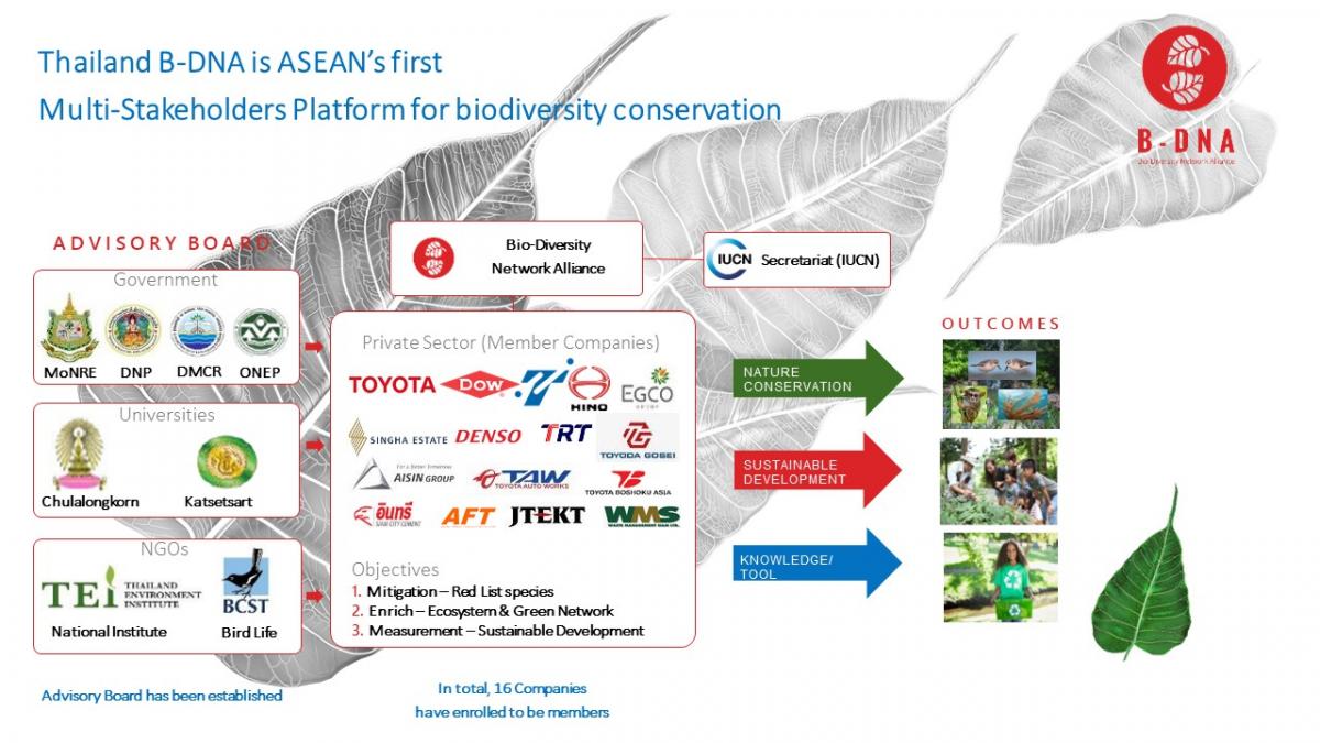
As part of its outreach efforts, IUCN Asia delivered a presentation about Thailand Thailand Bio-…
Our solutions are in nature is the theme for this year’s UN day of biodiversity on May 22.…
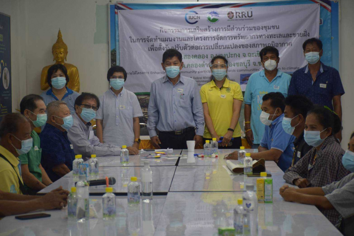
On 21 May 2021, Rajabhat Rajanagarindra University facilitated a community workshop to address…

Sign up for an IUCN newsletter