Assessing the Management Effectiveness of the Xe Champhone Ramsar Site through R-METT
From June 24th to June 27th 2019, IUCN Lao PDR facilitated a participatory assessment in Savannakhet Province, to evaluate the management effectiveness of the Ramsar designated Xe Champhone Wetland. The assessment was carried out using the Ramsar Management Effectiveness Tracking Tool (R-METT), and it aimed at determining key management constraints and strengths, as well as identifying current or growing threats to the site.
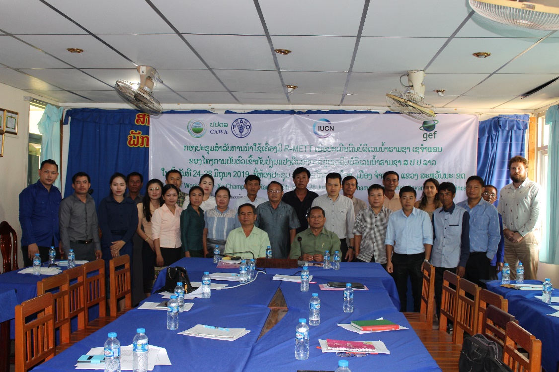
R-METT multi-stakeholeder assessment for the Xe Champone Ramsar Site, Champhone District, Savannakhet Province
Photo: ©IUCN
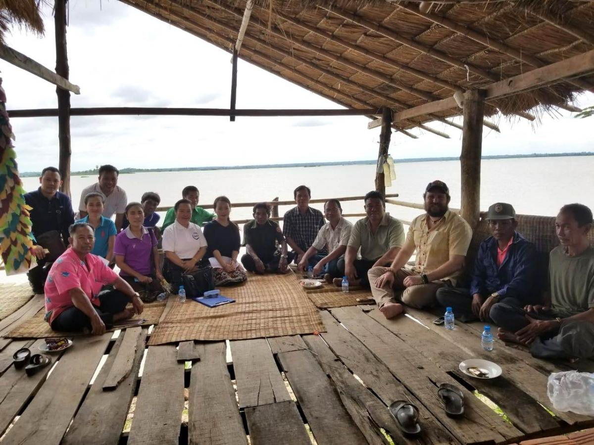
Community consultation at Ban Donyeng village, Sui Reservoir Lake
Photo: ©IUCN
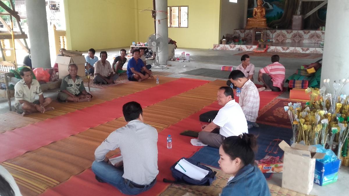
R-METT Community consultation in Ban Nonsithan, Xe Champhone Ramsar Site
Photo: ©IUCN
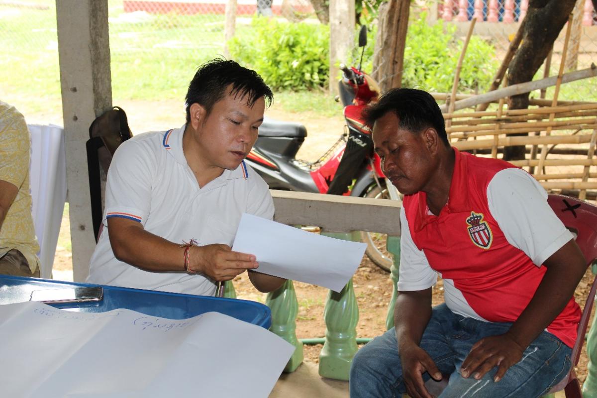
R-METT Community consultation in Ban Nakathang with men's group, Xe Champhone Ramsar Site
Photo: ©IUCN/Laura Handal
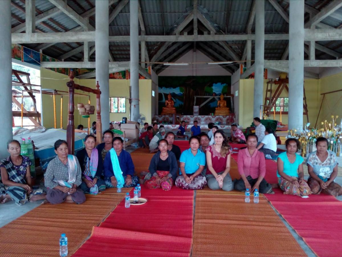
R-METT Community consultation in Ban Nakathang with women's group, Xe Champhone Ramsar Site
Photo: ©IUCN
The first three days of the assessment utilized a multi-stakeholder workshop format, and were held in Champhone district’s hospital meeting room facilities. A total of 30 people attended the event. Participants included central, provincial and district government staff, local community representatives, as well as representatives from the education and INGO sectors. More specifically, the meeting was attended by staff from the following government departments: Ministry of Natural Resources and Environment - Department of Environmental Quality Promotion (MONRE-DEQP), Provincial Office of Natural Resources and Environment of Savannakhet (PoNRE), District Office of Natural Resources and Environment of Champhone (DoNRE), Provincial Agriculture and Forestry Office of Savannakhet (PAFO) and District Agriculture and Forestry Office of Champhone (DAFO). Cluster village heads from Champhone district, representatives from Savannakhet University, the Ministry of Information, Culture and Tourism, the Food and Agriculture Organization of the United Nations (FAO), the Wildlife Conservation Society (WCS) and IUCN were also present.
The purpose of the event was to provide a preliminary assessment of current management at the Xe Champhone Ramsar Site, and to identify key next steps for future management in consultation with site mangers, community and other stakeholders. During the workshop, the R-METT assessment form was filled-out collectively, which meant that participants were asked a series of questions all throughout to identify any gaps or limitations in certain areas of management. After each question from the main assessment section was assigned a score, participants were asked to provide justification comments and to propose next steps of action.
On the fourth and last day of the event, community consultations were carried out in 15 villages located within and around the Ramsar site. Organizers visited these communities and conducted interviews with groups of villagers regarding management issues, using a shorter version of the main assessment questionnaire. In most villages, community members were divided into two groups based on gender prior to the discussions. A total of 120 villagers participated in such consultations.
The overall score for the site, as calculated from the three-day workshop, was 43.5% (47 points out of 108). Some of the key management constraints identified by the participants were: a lack of land and water use planning, little understanding and physical demarcation of on-the-ground site boundaries, absence of a management plan for the site, and insufficient or insecure budget for management tasks. On the other hand, the official recognition of the Ramsar Site by the central government, and the participation of local communities in management decisions were viewed as two of the main strengths for the site.
As for the threats to the wetland’s integrity, land-conversion for agricultural purposes, irrigation- and climate change-led aquatic habitat degradation, and over-harvesting of animals and non-timber forest products were viewed as some of the most important environmental pressures.
Samuel Leslie, Water and Wetlands Officer at IUCN Lao PDR, and one of the event organizers, summarizes some of the important next steps needed for the site, stemming from this assessment: “the future of the Xe Champhone Wetlands Ramsar Site relies on the establishment of land use planning and zonation, as well as site-specific regulations to protect land zoned as natural habitat, and to better control irrigation activities. There also needs to be a clear mandate for site managers to ensure legislation is respected.”
The outcomes of the R-METT assessment will be used to inform the development of the Xe Champhone Ramsar Site management plan that is currently being prepared.
The workshop was jointly chaired by the National Ramsar Focal Point from DEQP, Mr. Lonkham Atsanavong, and by Savannakhet’s PoNRE Deputy Director General, Mr. Nukhan Inthapanya.
The activity was held as part of the Climate Change Adaptation in Wetlands Areas in Lao PDR (CAWA) Project (GCP/LAO/022/LDF) funded by the Global Environment Facility (GEF) and implemented from 2016 to 2021. The CAWA Project is a collaboration between FAO, MONRE, IUCN and other partner agencies and organizations. FAO is the GEF executing agency, MONRE and IUCN are technical executing partners.
The R-METT assessment was implemented and supported by project counterparts from DEQP, PONRE, DONRE, in collaboration with IUCN and FAO, with the participation of village cluster heads within the Xe Champhone wetlands.
Related content

While expanding solar and wind will be an important factor in helping Vietnam to reduce its coal…

Vietnam’s has made impressive progress on its renewable energy transition, but the rapid expansion…
This is the fourth in a series of six web stories exploring how Viet Nam can implement its COP26…

Sign up for an IUCN newsletter